
The FiDi-Seaport Climate Resilience Plan is a comprehensive coastal-protection strategy designed to safeguard Lower Manhattan's waterfront communities from flooding and sea-level rise while enhancing public spaces and preserving the area's historic character. This plan addresses critical vulnerabilities across four key waterfront assets, ensuring the neighborhood remains resilient, accessible, and vibrant for future generations.
Ferry Hub
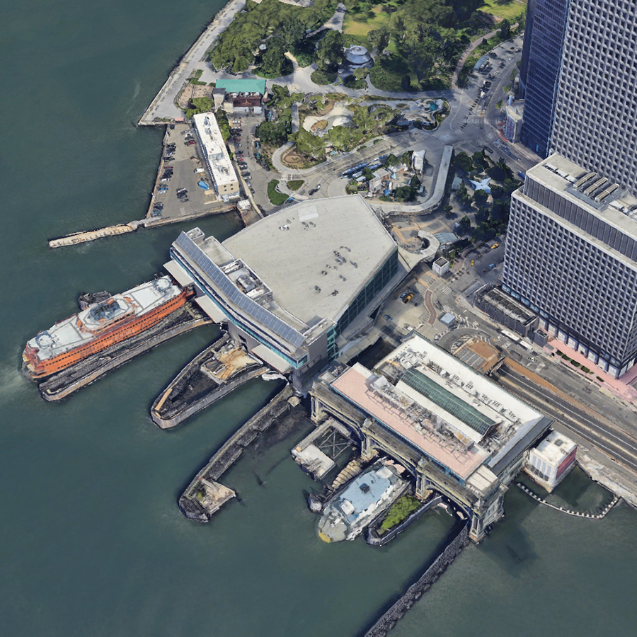
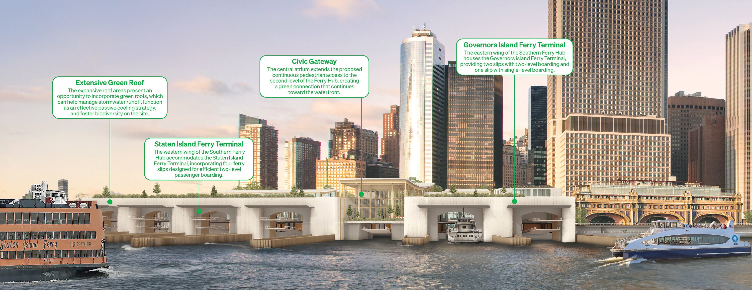
The waterfront from the Whitehall Ferry Terminal to Vietnam Veterans Memorial Plaza is a transportation hub that includes the Staten Island Ferry, the Battery Maritime Building, Governors Island Ferry, and the Downtown Skyport.
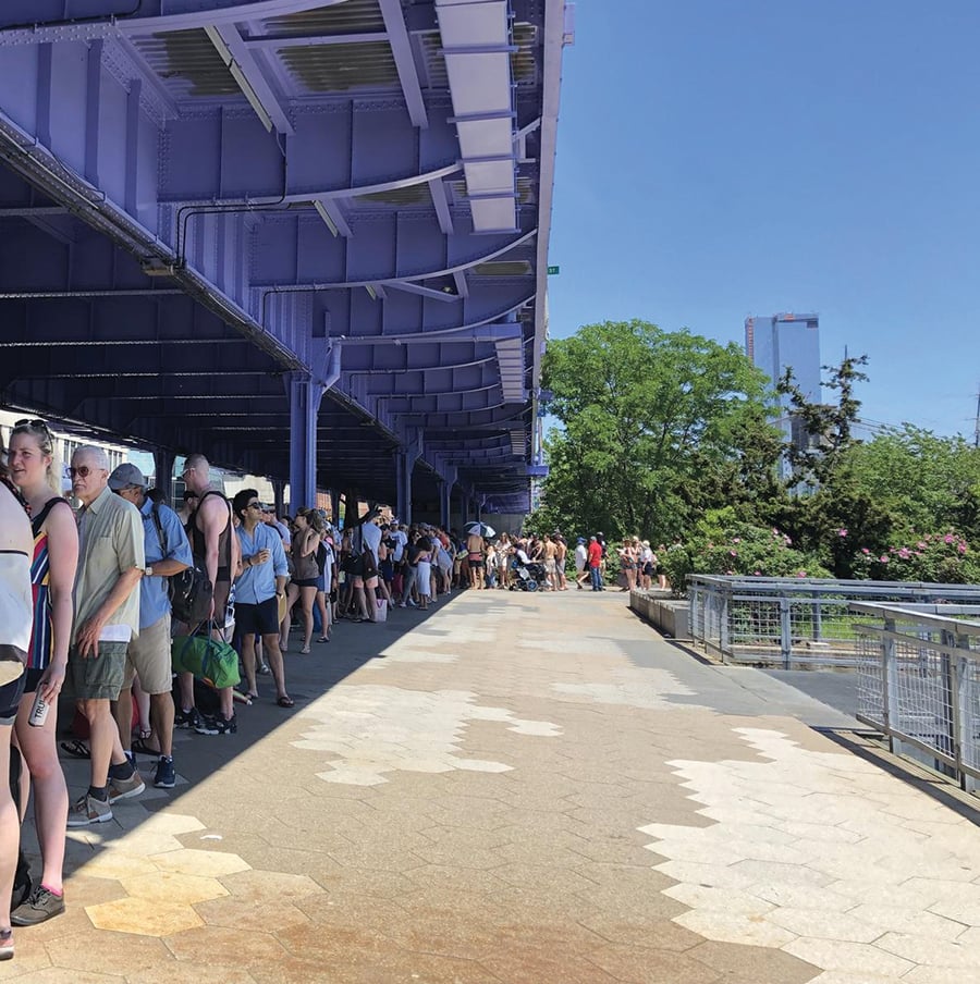
 Today: Whitehall Ferry Terminal, Governors Island Ferry, and the Downtown Skyport will experience monthly flooding by the 2050s, causing frequent service closures.
The Plan
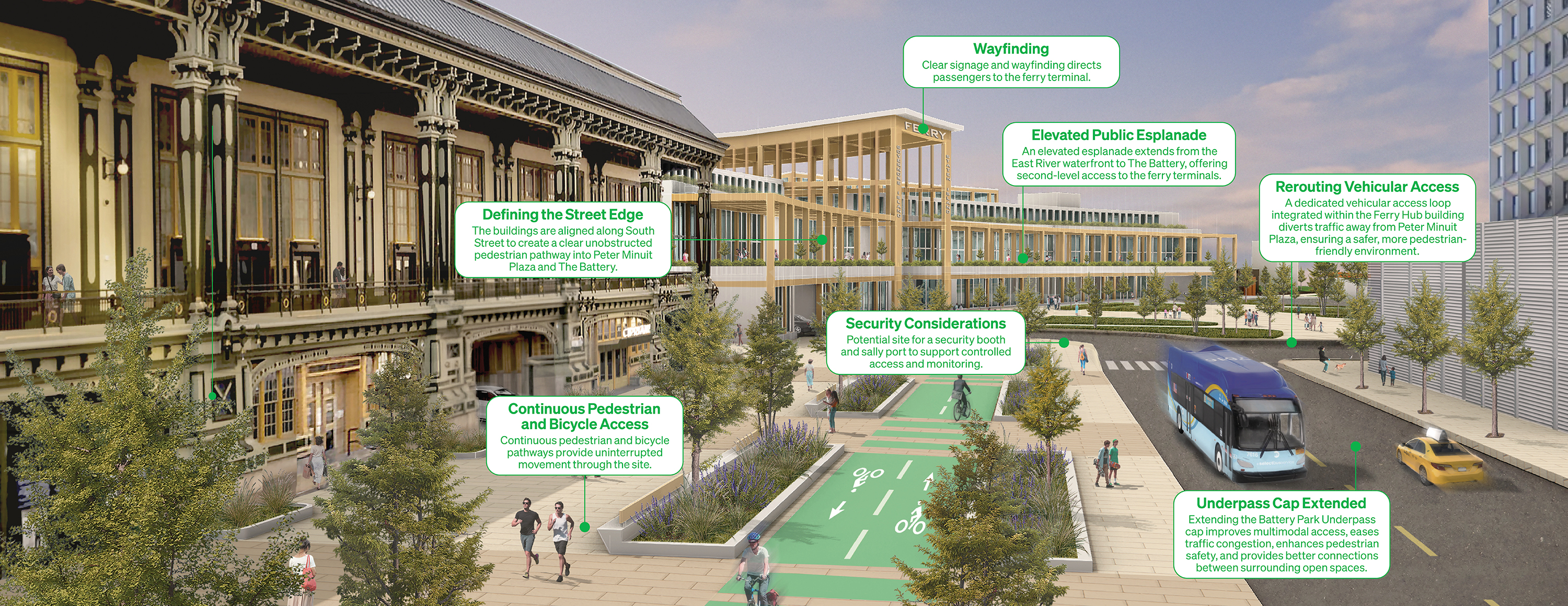
A new combined ferry terminal for the Staten Island and Governors Island ferries will be built and elevated, with construction phased to avoid disruptions to service. The historic Battery Maritime Building will be preserved and protected against storm flooding, and the Skyport will be elevated against sea-level rise.
Pedestrian and bicycle access in this area will be improved through a new public plaza inland of the Battery Maritime Building that will cap over the Battery Park Underpass.
Harbor View Park
The new two-level waterfront will protect the neighborhood from coastal flooding while expanding recreational opportunities.
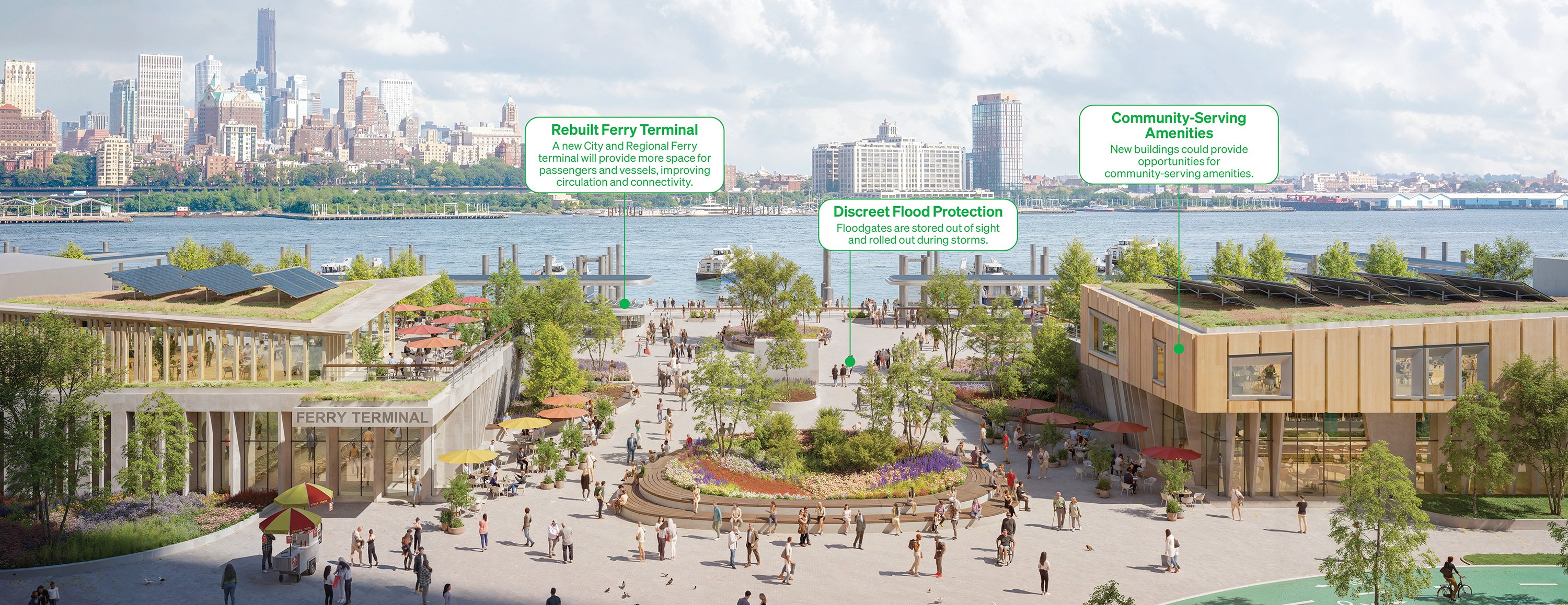
 Today: NYC DOT’s Wall Street/Pier 11 ferry landing for regional and City ferry services, located between the FDR Drive and the shoreline, is narrow, making it challenging to accommodate flood defense and public programming. There is also inadequate queuing space for ferries, causing pedestrian and bicycle congestion along the waterfront.
The Plan
The Wall Street/Pier 11 ferry landing will be rebuilt with more space for passengers and vessels to support regional and NYC ferry services.
To the north of the ferry terminal will be a new signature open space built on the shoreline extension that steps down towards the water, creating better views, recreational space, and pedestrian connections.
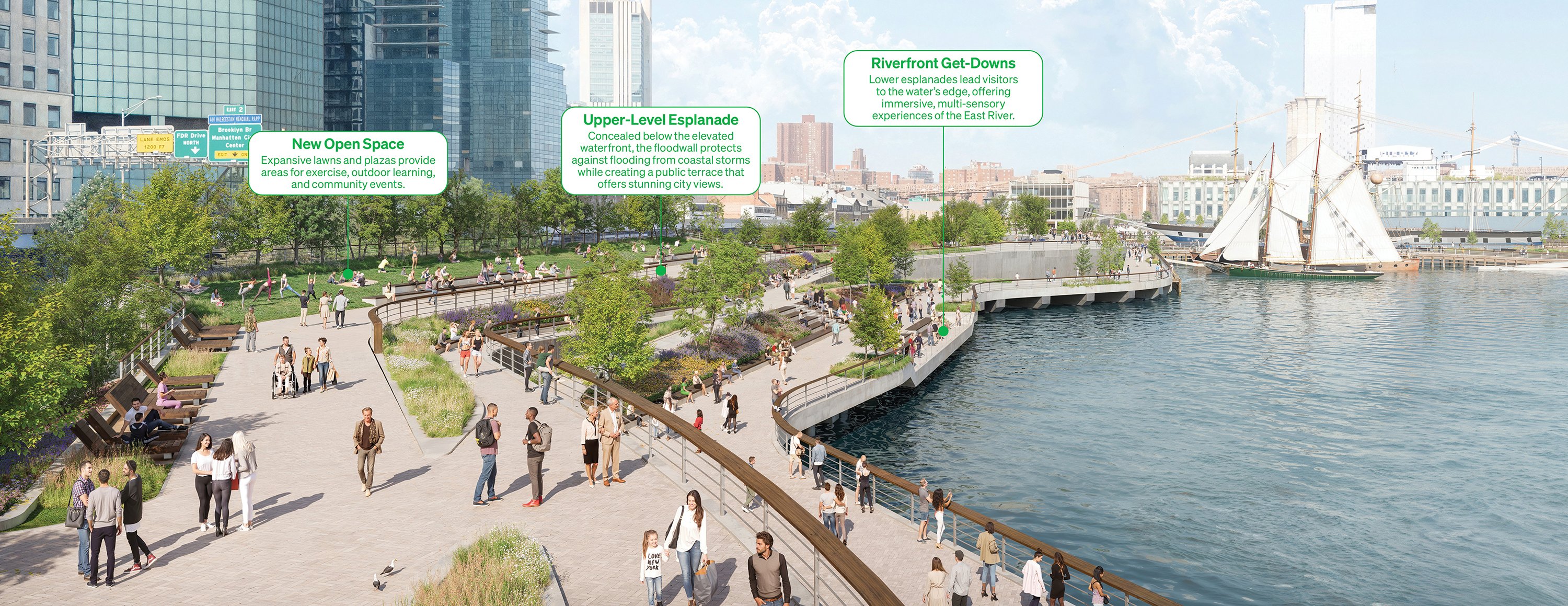
Seaport Piers
The Seaport Piers area will preserve the historic South Street Seaport’s connection to the waterfront while protecting it from flooding.
 Today: The Seaport District is a vibrant cultural and historic neighborhood that is a destination for both residents and visitors. Pier 17 was elevated to protect against storms after Hurricane Sandy, but Piers 15 and 16 will experience monthly flooding by the 2080s.
The Plan
Historic uses in this area will be maintained and protected in the new design. Pier 16 will be elevated, and Pier 15 will be replaced by a new Pier 19 to the north. Floodgates will provide direct access to the water from the city.
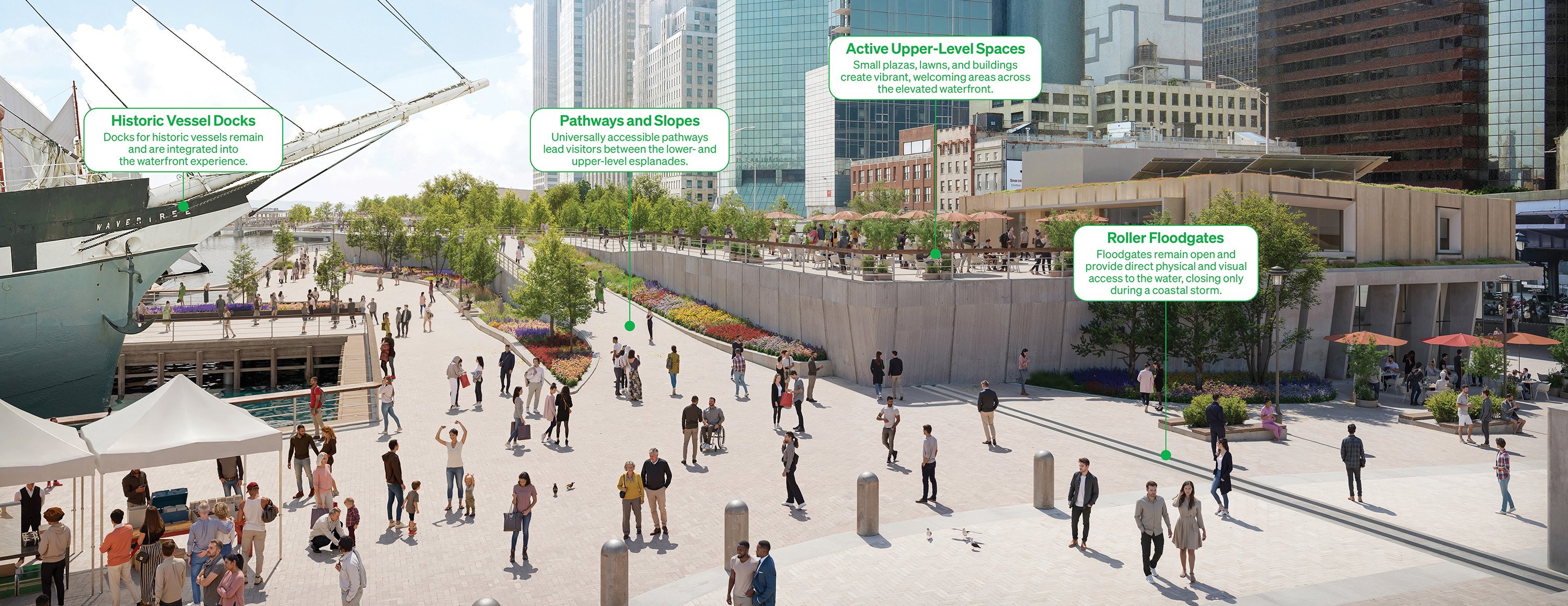
A new small cove by the Brooklyn Bridge could create recreational and ecological opportunities. The flood wall will also connect to the adjacent Brooklyn Bridge-Montgomery Coastal Resilience project.

Southern Tie-In
The southern portion of the project must connect to the adjacent South Battery Park City Resiliency project at Bowling Green to create one continuous line of flood defense around Lower Manhattan.
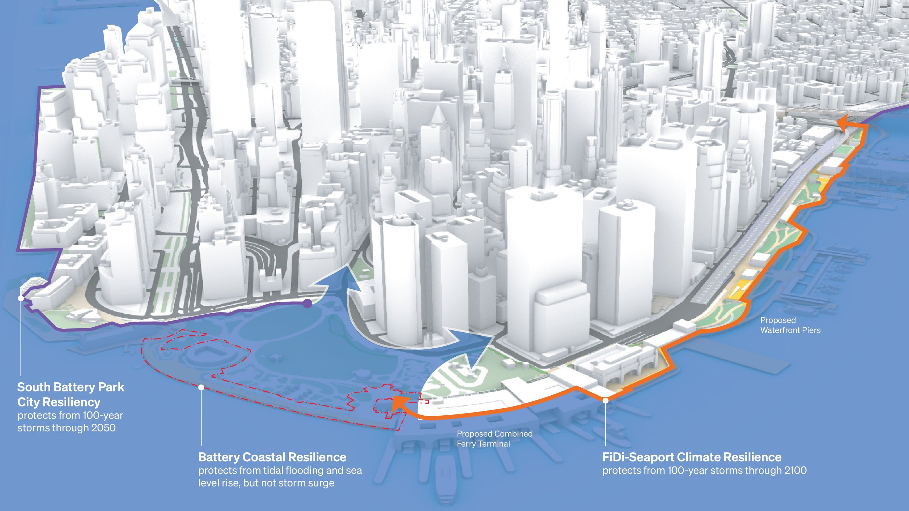 Today: Three flood-resilience projects come together at the southern tip of Manhattan and need to connect to create a closed flood-protection system. Extensive studies of above-ground and subsurface infrastructure constraints determined that the only technically feasible alignment to connect the flood protection at Whitehall Ferry Terminal to the South Battery Park City Resiliency project was to go through The Battery.
The Plan
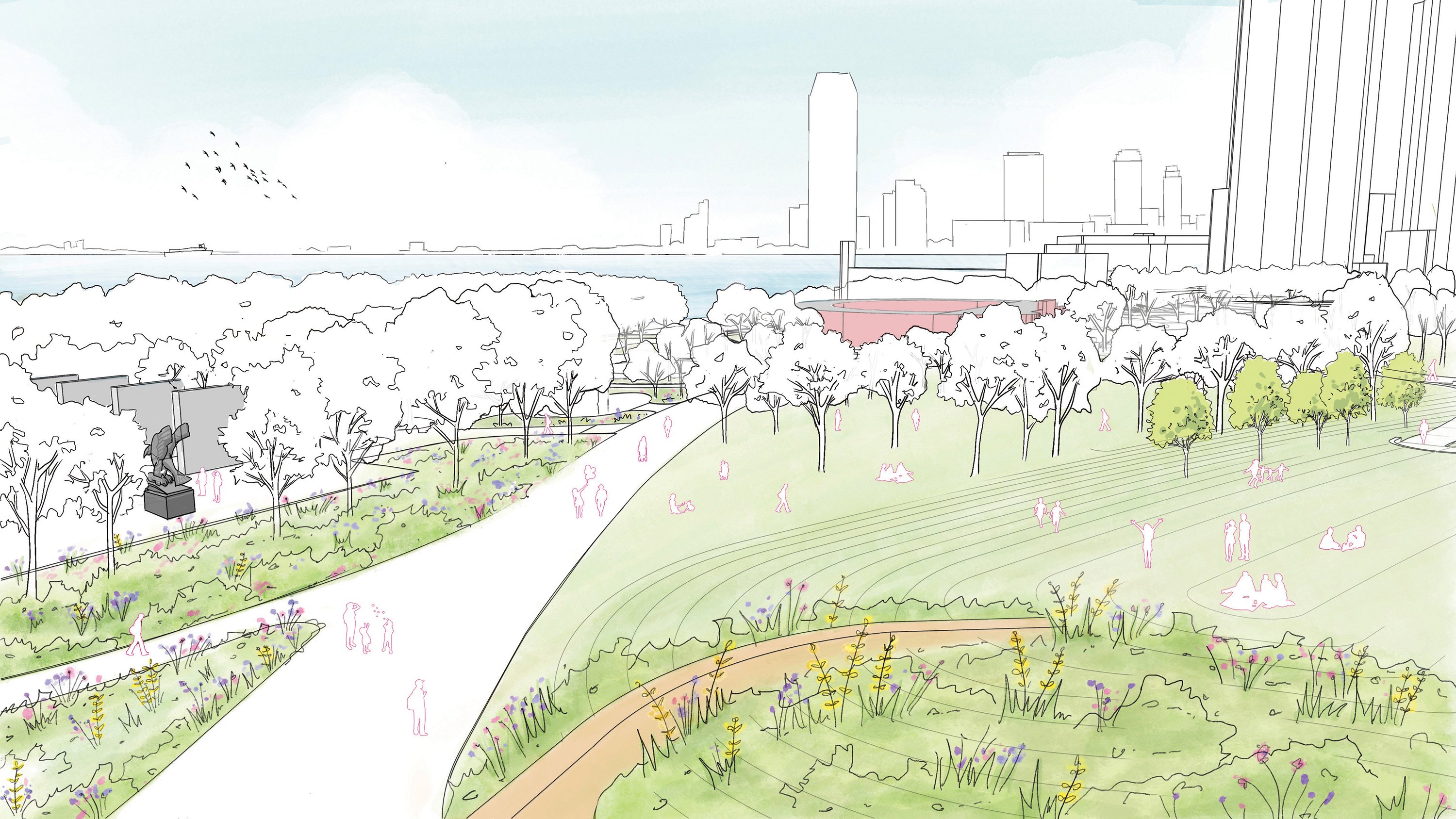
The flood defense will need to weave through a complex web of subsurface infrastructure, including subway tunnels, the Battery Park Underpass, and the Hugh L. Carey Tunnel. To minimize underground and above-ground disturbances and avoid walling off the park from the water, the floodwall will be buried under the landscape in The Battery to create a gently sloping landform that offers new opportunities for open space and public programming and will create new views of the water.
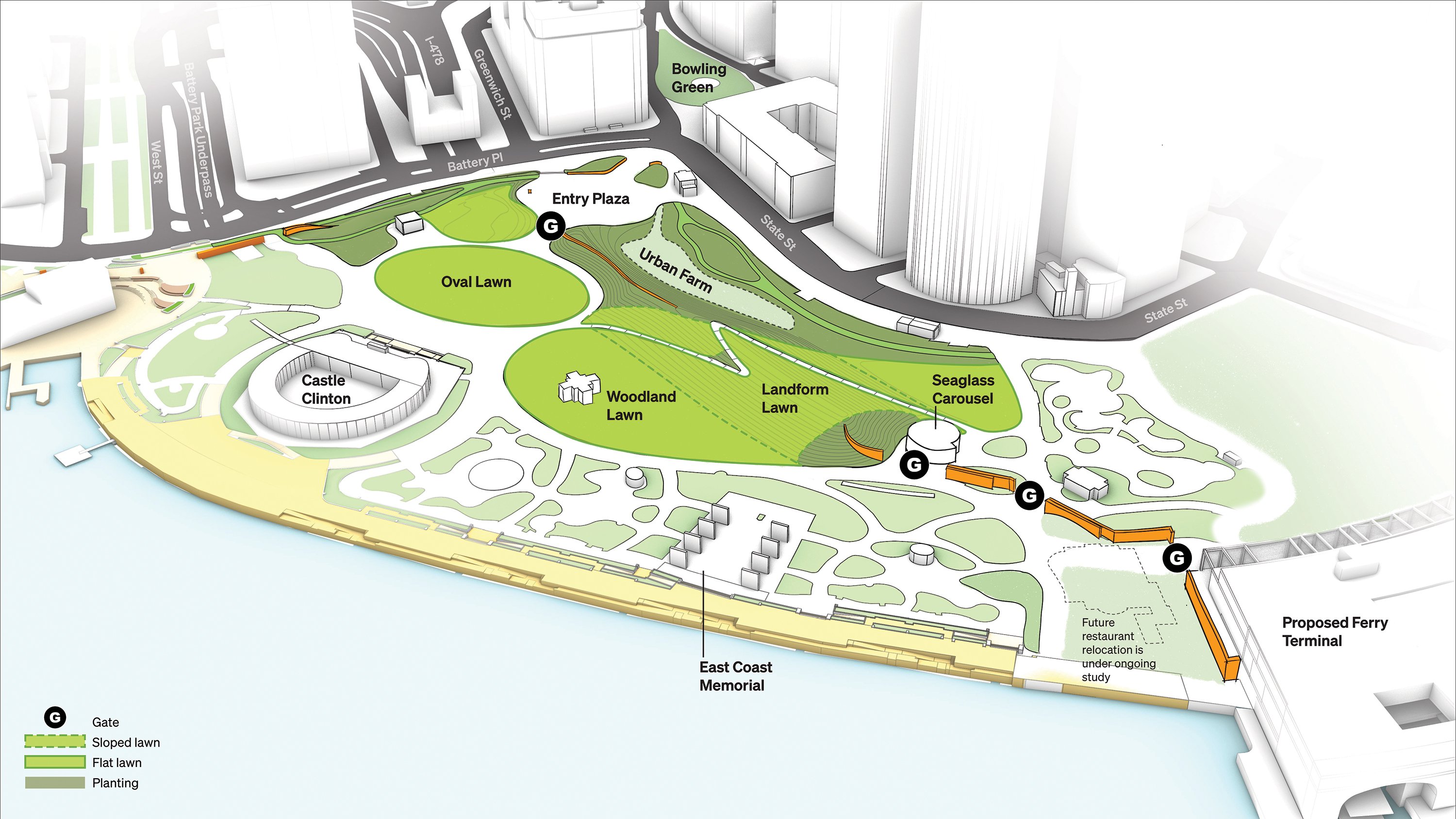
As a result, part of The Battery will be designed to be floodable during storms, while beloved assets such as the Seaglass Carousel, the urban farm, and Battery Playscape will be protected from flooding.
Stay in the Know
Receive our emails with updates and event invitations.